What Will It Look Like
Roadway Designs
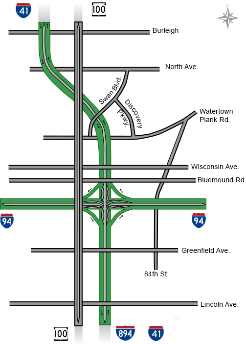
The Zoo Interchange project reconstructed several local arterials to be used as detour routes when major construction takes place. These arterial projects include bridge reconstructions over highways, capacity expansion, and even new roadway construction. Eight major arterials received design improvements – Click on the map below to see the final roadway configurations.
Walls and Noise Barriers
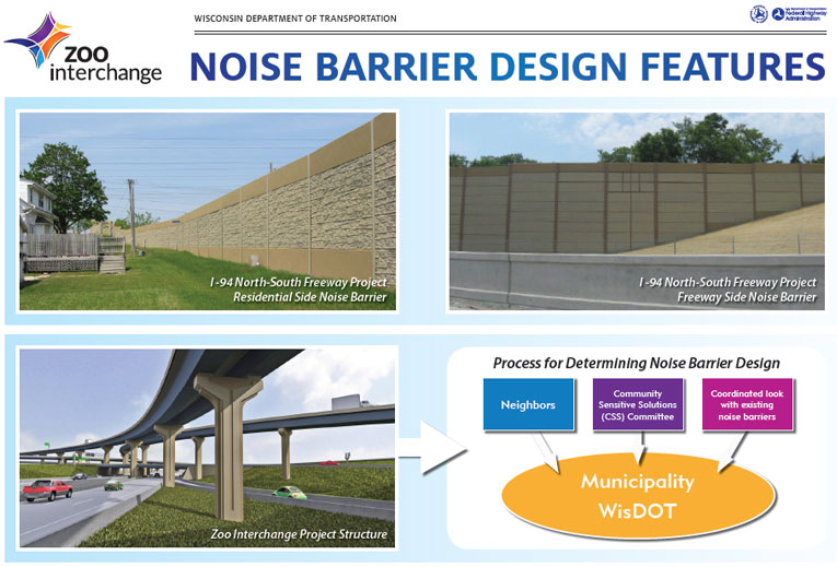
At the start of the Zoo Interchange project, the Wisconsin Department of Transportation (WisDOT) determined noise impacts and evaluated possible mitigation measures, such as noise barriers.
After careful evaluation and a voting process, WisDOT chose the following locations along the Zoo Interchange corridor to install noise barriers in order to minimize noise impacts:
- West Allis – along I-41/894, areas north and south of Greenfield Avenue
- Milwaukee – along I-94 between the core of the Interchange and 70th Street, and along residential areas adjacent to the core of the interchange
- Wauwatosa – along I-41, in the north leg of the corridor, north of Bluemound Road
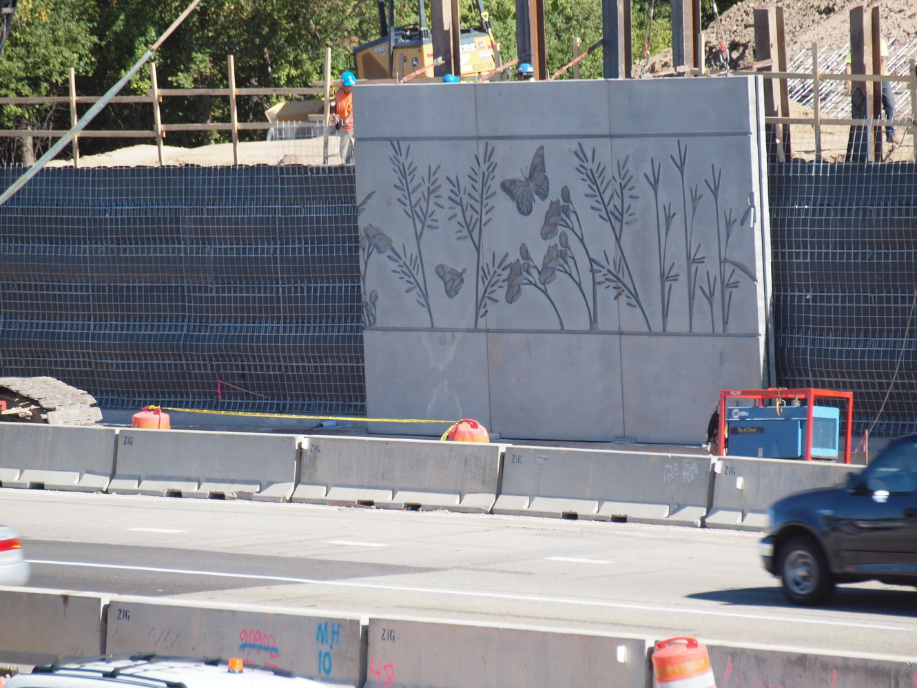
These locations were selected based on a noise analysis that predicts future noise levels. Click on the image below to see the noise barrier features.
Railroad
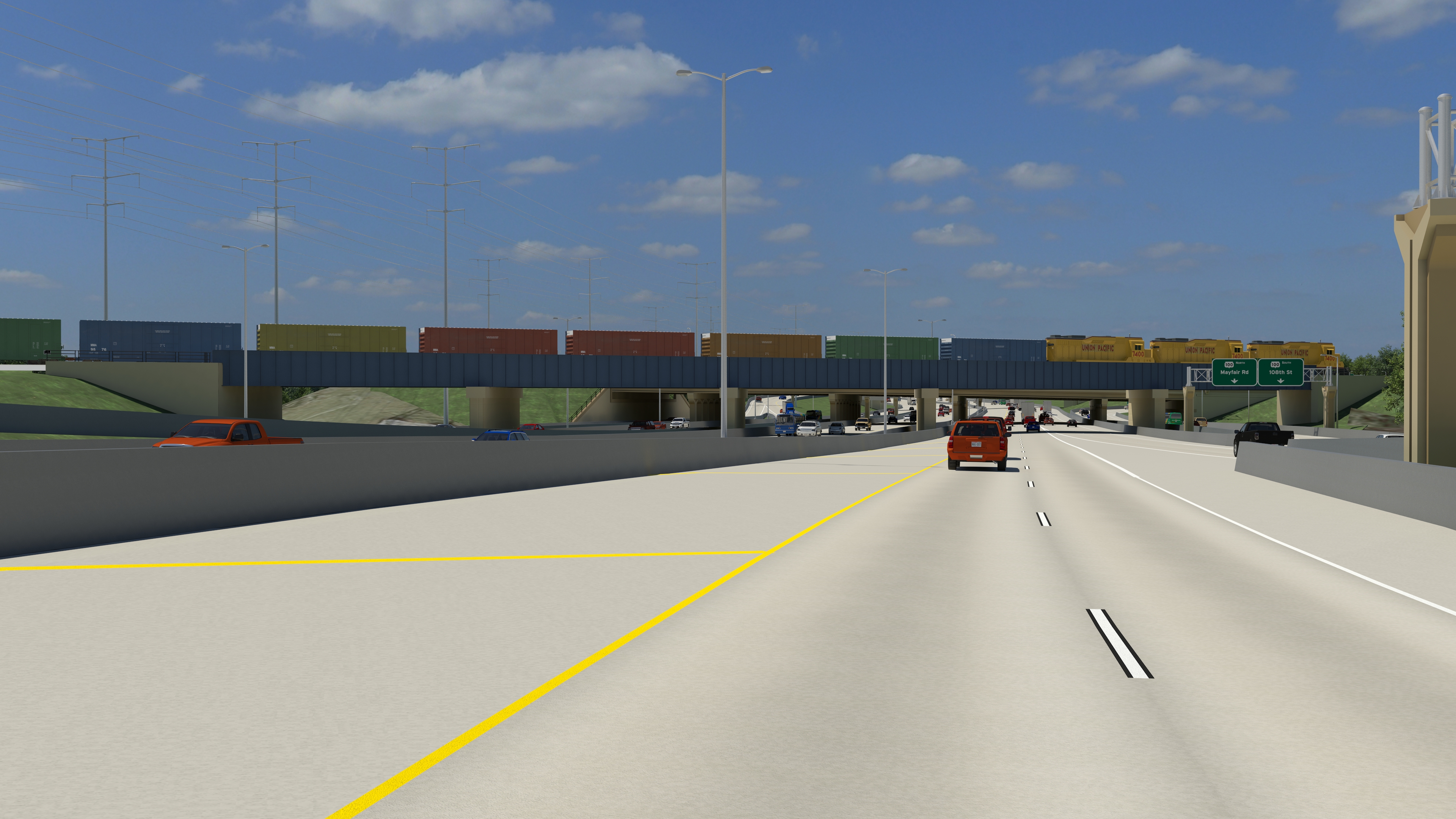
Union Pacific Railroad has two bridge structures over I-94 and I-41 that will be reconstructed as part of the Zoo Interchange project. The railroad bridge over I-94 near WIS 100 was reconstructed as part of the WIS 100 Interchange project. The railroad bridge over I-41 near North Avenue/Mayfair Road will be reconstructed as part of the North Leg project. It’s vital to Union Pacific Railroad to maintain these routes throughout construction. Click on the image below to see a visualization of the completed Union Pacific Railroad bridge over I-94 near WIS 100.
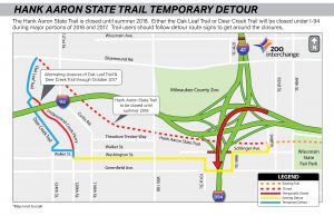
Hank Aaron State Trail
The Hank Aaron State Trail (HAST) was repaved from 94th Place to the Oak Leaf Trail as part of the Zoo Interchange project.
Community Sensitive Solutions
Community Sensitive Solutions (CSS) is a community-based approach to planning and designing transportation projects. The CSS process helps WisDOT achieve a vision that improves the transportation work through the use of fencing, landscaping, walls, bridge work and specific color schemes to enhance the surrounding area. The Marquette and Mitchell Interchanges are fine examples of what we can do to enhance Wisconsin’s infrastructure in a cost-effective way.
In summer 2011, WisDOT initiated a CSS program to engage businesses, residents, property owners and community leaders. Feedback was obtained on elements of the project including construction materials, colors and overall appearance.
Features have been included in the streetscaping plans for local roadways. The plans also established aesthetic concepts for bridges and walls and were included in the Zoo Interchange freeway design. Proposed CSS features were implemented and are maintained with a combination of state and local funds.
 |
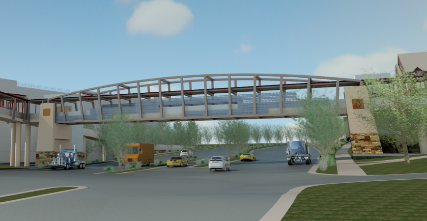 |
| View of the Butterfly Wall design on I-41 at Swan Boulevard | Visualization of the Watertown Plank Road Pedestrian Bridge that connects Children’s Hospital and the Ronald McDonald House |